Source: http://geology.com/asia-satellite-images.shtml
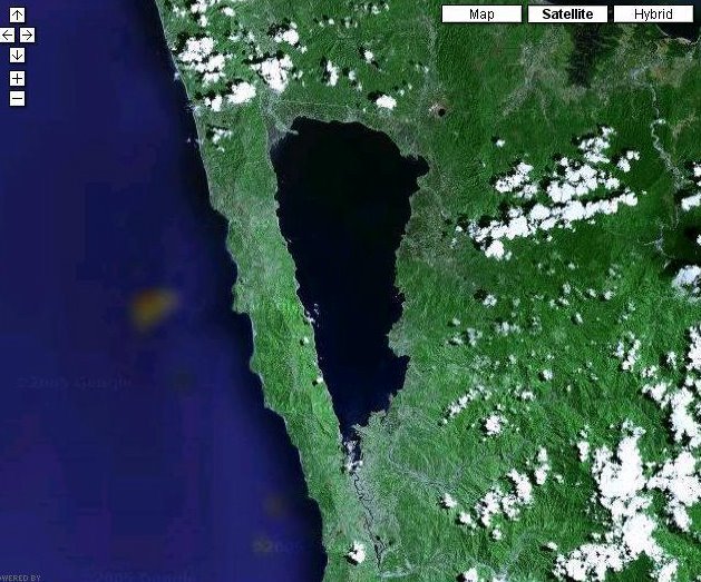
Mainit Lake is the dark blue pear-shape figure in this image. It is the country's fourth largest lake and has an area of 58 sq mi (150 sq km).
The left portion of the image is the Surigao West Coast.
I USED THIS IMAGE (shape) for the Lake Mainit Shirt Designs.
By: Zimmbodilion Mosende
Feb 4, 2006
Categories: photos, welcome, mainit, mindanao, philippines
No comments:
Post a Comment